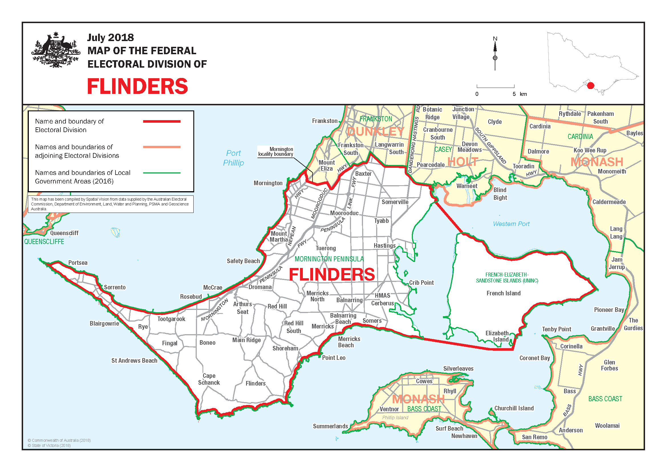
The Flinders Electorate
Download the
Flinders Electorate Map
[PDF 864KB]
Flinders is named after the famous explorer and navigator Matthew Flinders (1774–1814), who was the first person to circumnavigate Australia. The adoption of the name ‘Australia’ is due to him.
Flinders is a rural division which encompasses from Portsea in the south west to Mornington, Baxter, and Somerville in the North, down Western Port and across the Mornington Peninsula.
Local industries include a steel-rolling mill, dairy farms, fishing, poultry, wineries, orchards, light industry and tourism. The electorate also has a rich sporting tradition, having bred many great football players, sailors, surfers, swimmers, netballers and runners.
The Flinders electorate surrounds and encompasses Western Port, including French Island and Phillip Island, and covers much of the Mornington Peninsula. Localities include:
| ARTHURS SEAT | MERRICKS NORTH |
| BALNARRING | MOOROODUC |
| BALNARRING BEACH | MORNINGTON |
| BAXTER | MOUNT MARTHA |
| BITTERN | POINT LEO |
| BLAIRGOWRIE | PORTSEA |
| BONEO | RED HILL |
| CAPE SCHANCK | RED HILL SOUTH |
| CAPEL SOUND | ROSEBUD |
| CRIB POINT | RYE |
| DROMANA | SAFETY BEACH |
| ELIZABETH ISLAND | SHOREHAM |
| FINGAL | SOMERS |
| FLINDERS | SOMERVILLE |
| FRENCH ISLAND | SORRENTO |
| HASTINGS | ST ANDREWS BEACH |
| HMAS CERBERUS | STONY POINT |
| MAIN RIDGE | TOOTGAROOK |
| MCCRAE | TUERONG |
| MERRICKS | TYABB |
| MERRICKS BEACH |


